Baoqi Smart has completed the OSSInt 2026 submission package for SHEEPDOG Resilience Mapper—a deterministic browser demonstration of how open geospatial data can support resilient search decisions.
災害現場真正稀缺的,不只是空拍畫面,而是下一步該往哪裡找。寶淇智慧以 SHEEPDOG(牧羊犬)Resilience Mapper,展示如何把開放空間資訊轉成持續更新、可重現且可稽核的搜索決策。
From open data to a continuously updated search decision
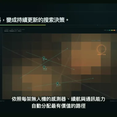
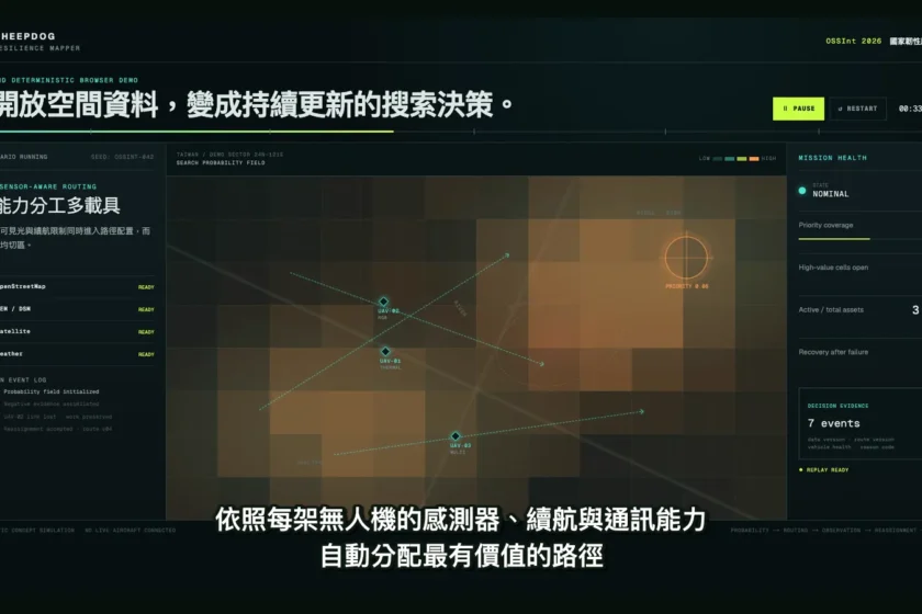
The demo fuses OpenStreetMap, DEM/DSM, satellite imagery and weather inputs into a search-probability field. It then allocates high-value routes according to each vehicle’s sensor fit, endurance and communications state.
- Open-data fusion: combine spatial sources into a versioned probability field.
- Sensor-aware routing: assign heterogeneous UAVs according to capability rather than dividing the map evenly.
- Negative-observation updates: reduce priority in searched areas and redirect available assets toward unresolved hotspots.
- Failure reassignment: preserve unfinished work and constraints after link loss, then reassign the task within the demonstrated 6.8-second recovery window.
- Decision evidence: retain data, route, health-state and reassignment records for reproducible review.
Open the interactive demo:
https://sheepdog-resilience-demo.areios-chang.chatgpt.site/
This is a deterministic browser simulation and does not represent field acceptance, live-aircraft control or a completed operational deployment. No real aircraft are connected to the demonstration.
About Baoqi Smart
Baoqi Smart builds the mission layer for heterogeneous autonomy across high altitude, air, sea and ground—from simulation evidence to bounded edge execution.